Kentucky Route 1954
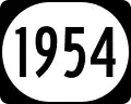 Kentucky Route 1954 | ||||
|---|---|---|---|---|
| Husbands Road | ||||
KY 1954 highlighted in red | ||||
| Route information | ||||
| Maintained by KYTC | ||||
| Length | 6.537 mi[1] (10.520 km) | |||
| Major junctions | ||||
| South end |  KY 348 near Freemont KY 348 near Freemont | |||
 I-24 Exit 11 I-24 Exit 11 | ||||
| North end |    US 62 / US 60 Bus. east of Paducah US 62 / US 60 Bus. east of Paducah | |||
| Location | ||||
| Country | United States | |||
| State | Kentucky | |||
| Counties | McCracken | |||
| Highway system | ||||
| ||||
| ||||


Kentucky Route 1954 (KY 1954) is a north–south secondary highway located entirely in McCracken County in western Kentucky.[2]
Intersections
The entire route is in McCracken County.
| Location | mi[1] | km | Destinations | Notes | |
|---|---|---|---|---|---|
| | 0.000 | 0.000 | KY 348 (Hardmoney Road) | Southern terminus | |
| 2.142 | 3.447 |   KY 999 west (Krebs Station Road) KY 999 west (Krebs Station Road) | Eastern terminus of KY 999 | ||
| 3.125 | 5.029 |   KY 3075 east (Lydon Road) KY 3075 east (Lydon Road) | Western terminus of KY 3075 | ||
| Paducah | 3.634 | 5.848 | I-24 – St. Louis, Nashville | I-24 Exit 11 Begin concurrency with  I-24 BL I-24 BLEastern terminus of I-24 Business | |
| 3.923 | 6.313 |   KY 2187 north (Husband Drive) KY 2187 north (Husband Drive) | Southern terminus of KY-2187 | ||
| 6.076 | 9.778 |   KY 450 south (Oaks Road) KY 450 south (Oaks Road) | Northern terminus of KY 450 | ||
| 6.537 | 10.520 | US 60 (Beltline Highway) / US 62 / US 60 Bus. west / I-24 BL west – Paducah, Calvert City, Smithland | Northern terminus; end concurrency with I-24 Business; eastern terminus of US 60 Business | ||
1.000 mi = 1.609 km; 1.000 km = 0.621 mi
| |||||
References
- ^ a b Commonwealth of Kentucky. "Official DMI Route Log". Retrieved July 7, 2016.
- ^ DeLorme (2010). Kentucky Atlas & Gazetteer (Map) (4th ed.). Yarmouth, ME: DeLorme. Page 59.
External links
Template:Attached KML/Kentucky Route 1954
KML is not from Wikidata